
Welcome to JVFR
would you like to install the app, or use the browser version? Installing the app is recommended for operational use, as it allows for offline functionality.

Log in to your account
Checking login information...
Your account was registered succesfully! You can now log in with your new credentials.
password incorrect
User not found. Please that your username is case sensitive.
No account yet? click here to register.
Register an account
JVFR is completely free, no charges or in-app purchases apply.
This username or email is already in use
Your passwords don't match. Check them and try again
This doesn't appear to be a valid email address. Please try again
Log in instead? click here.

Important information
You are currently using a pre-release version of JVFR. Some features are incomplete, and bugs may occur. DO NOT use JVFR as your primary source for flight preparation yet, until version 1.0 is released.
Current version:
An update is being downloaded
Routes
Save, load and manage routes.
What would you like to do?
Save current route
There is no route drawn on the map. Please close this overlay and draw a route first.
Draw a route on the map using this button in the top left of the map:
When you are done, the details of your route will be shown here. You can then name it and save it to the database.
Total length: 5nm
Estimated flighttime: 60 minutes
A name and description are optional
Route saved!
Your route was saved successfully.
Load a route
Select a previously saved route from the list below to load it onto the map.
EHTE-EHTX
A route to Texel via the Ijsselmeer, passing De Kooy
Length: 12 NM
Saved on 11/08/2023 19:12
Total length: -
Estimated flighttime: -
Route is reversed
Route deleted
(Click anywhere outside of this menu to close)
EHAA
MIL ACFT HAVE TO AVOID OVERFLYING OF BETUWE DUE TO BREEDING BIRDS PSN 515057N 0050900E RADIUS 0,5NM BTN GND/1000FT AGL.
Lower limit: FL000
Upper limit: FL999
Issued: 2021-04-01
Valid from: 2021-04-01
Valid until: 2021-04-01
Map settings
Change active map layers and related settings.
Map base layers
Select the map layers you want to use. Most maps are ''basemaps'', but some are overlays that are put over another basemap.
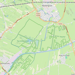
Simple 1 (online, OSM)
Open street map default layer
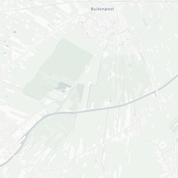
Simple 2 (online, OSM)
A colour-light version of the default map
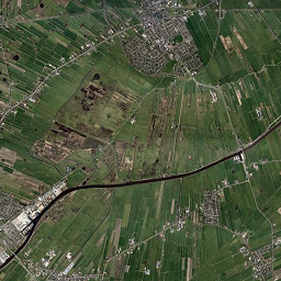
Sattelite (online, ESRI)
Global sattelite imagery
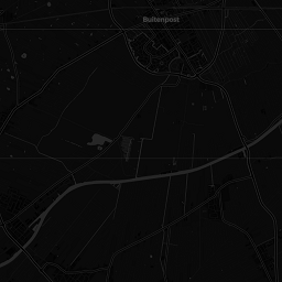
Dark (online, cartoDB)
A dark basemap
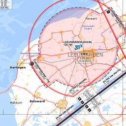
VFR chart NL (offline)
An offline VFR chart for NL and BE
Map overlays
Select an overlay that is rendered on top of the base layer
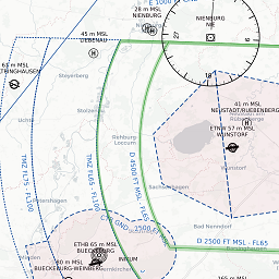
OpenAIP airspaces (online)
Global aviation map
A circle will be shown around your aircraft indicating the glide range based on your aircraft's glide ratio (e.g. 9:1 for a C172).
Increases the frequency at which your GPS position updates. Turn off if your battery is draining too quickly.
Increases the frequency at which traffic positions update. Turn off if your battery is draining too quickly.
If Track-up mode is enabled, the map will rotate so that your direction of travel is always pointing up. If disabled, the map will always be oriented with North pointing up. The map will only rotate when following your position using GPS.
Parallax allows traffic markers to be displayed in 3D based on their actual altitude. This setting may help you to better understand the altitude of traffic, but it may also cause performance issues on slower devices or cause confusion about the actual position of an aircraft.
Traffic maximum altitude
15000ft
Sets the maximum altitude at which traffic is still displayed. This setting can help reduce clutter on the map. Any aircraft flying higher than this altitude will not be shown on the map.
Traffic search distance
70 nm
Sets the distance around your current location where traffic is included. Higher settings may cause performance issues on slower devices.
Offline mode
Preparing databases...
0%
This needs to run when first installing the app or after updates. While the dataset is downloading, you can select a different (online) map layer in the top right.
Direct To
Airfield not found in database
Closest fields
Current country: nl
| Quick flight info | |
| Time (UTC): | --- |
| Time (local): | --- |
| Groundspeed: | 0 kn |
| GPS altitude: | 0 ft |
| Dist. to next WP: | 0 nm |
| Time to next WP: | 0 min |
| Total route time remaining: | 0 min |
---
Current heading
GPS acquiring fix...
---
Heading to wp
(bearing: -)
Satellite and radar imagery
The map below shows past, current and forecast precipitation based on radar. You can look for METAR reporting stations via the buttons below the map. Additionally, the map can show current cloud coverage as seen by infrared satellite observations.
Click anywhere to find the closest METAR reporting station
Currently showing: past
16:30 local time
Now
Radar layer opacity
70%
Wind altitude
METAR and wind
Read the METAR and any TAFs for your selected location below. The wind of this METAR will be used for all speed calculations (winds aloft are currently not included!)
Error
Sorry, we couldn't find a metar for this location. Please try somewhere else.
| METAR selected location | |
|---|---|
| Station | |
| Flight rules | |
| Wind heading | |
| Windspeed | |
| Windspeed | |
| Temperature | |
| QNH | |
| Dewpoint | |
| Field elevation | |
| Density altitude | |
| Pressure altitude | |
| Visibility | |
| Time of report | |
| Clouds | |
| Weather | |
No TAF available for this station
Collecting TAFs...
| TAF for EDLS | |
|---|---|
| Time | |
| Flight rules | |
| Type | |
| Clouds | |
| Weather | |
| Wind | |
| Visibility | |
| Probability | |
Crosswind indicator
North-up mode


Crosswind
0 knots
Headwind
0 knots
Wind heading
Wind speed
Runway heading
Information source
METAR/TAF information is sourced from AVWX. Weather radar and satellite imagery are gathered from Rainviewer. When radar data is outdated, a warning text will be displayed above the map. Always check that the radar and METAR data you are currently viewing is current!
Select a GPS marker
Cessna 172
Piper cub
Piper archer
Generic general aviation
Generic business jet
Generic airliner
Helicopter
Gloster meteor
J35 Draken
F104 Starfighter
F14 Tomcat
F18 Hornet
F22 Raptor
F35 Lightning
B2 Spirit
Aircraft setup & calculations
This tab allows you to set up your aircraft information, perform fuel calculations and do your mass & ballance.
Current active aircraft
PH-TGM
Cruise: 90 kn
Change active aircraft
You already have 50 aircraft saved. Please delete or modify an existing aircraft.
You cannot delete the last aircraft in the list. Please add another aircraft first.
New aircraft saved.
Aircraft deleted.
Create new aircraft
Fill in the fields below to set up your aircraft. You can have ten aircraft active at a time.
Distance and speed units
Weight units
Fuel units
Fuel type
Insufficient fuel!
Insufficient fuel!
Insufficient fuel!
Your total fuel should include the unusable fuel left in the tanks! The mass of the unusable fuel is already included in the basic empty weight of your aircraft, but it's important to know how much of the total fuel capacity is available for fuel performance calculations.
The glide ratio of your aircraft at your best glide airspeed. For example, a C-127 has a glide ratio of 9 at 68kn, meaning that for every 1 foot of altitude the plane can traverse 9 feet horizontally.
Deviation table
If you want bearings to be corrected for your plane's magnetic deviation, please fill in the table below.
| For... |
|---|
| Steer... |
| 0° |
|---|
| 30° |
|---|
| 60° |
|---|
| 90° |
|---|
| 120° |
|---|
| 150° |
|---|
| 180° |
|---|
| 210° |
|---|
| 240° |
|---|
| 270° |
|---|
| 300° |
|---|
| 330° |
|---|
Mass & balance data
For your mass & balance, we need to know where everything positioned. Fill in the arms of the various weights in inches aft of the datum line. Any loading points that are not applicable to your aircraft can be left blank.
Insufficient fuel!
Center of gravity moment envelope
Finally, we need to know what the center of gravity moment envelope of your aircraft looks like. You can modify it with the inputs below.
You can modify the profiles by changing the X and Y coordinates of each corner. If your profile has fewer corners than listed below, leave the remaining options blank.
Normal category
X
Y
Utility category
X
Y
GPS marker
You can select a different GPS marker below.
Cessna 172
Cannot save aircraft, some information is missing. Please complete the required datafields and try again.
An aircraft with this registration is already registered by you. Please use a different registration, or modify the existing aircraft.
Mass & balance inputs
Calculate the mass and balance for your currently selected aircraft.
Fuel planning
Specify your desired flight time in minutes to check how much fuel you need, and whether you have sufficient fuel on board.
Tank fill level
Flight time in minutes. Automatically set to the required amount if a route is planned on the map.
How many minutes it would take you to reach your alternate at the furthest point in your journey.
Any additional emergency flight time to keep in mind.
The altitude you will be cruising at, required to calculate climb fuel consumption. If left empty, an altitude of 1.000ft is assumed.
Center of gravity moment envelope
Your zero fuel mass, take-off mass and landing mass will be displayed below. If any of these points are outside of the envelope, your aircraft is not loaded correctly for flight!
Calculated mass and moments
This table displays the mass and calculated moment for each object onboard your aircraft. The mass and moment at take off, landing and zero fuel are highlighted and displayed in the Center of gravity moment envelope.
| Mass and Balance | Mass | Arm | Moment |
|---|---|---|---|
| (category) | (Lbs) | (inch) | (in-lbs/1000) |
| B.E.W. | - | - | - |
| Pilot+copilot | - | - | - |
| Passengers 1 | - | - | - |
| Passengers 2 | - | - | - |
| Baggage 1 | - | - | - |
| Baggage 2 | - | - | - |
| Zero fuel mass | - | - | - |
| Fuel on board | - | - | - |
| Ramp mass | - | - | - |
| Taxi fuel | - | - | - |
| Take off mass | - | - | - |
| Trip fuel | - | - | - |
| Landing mass | - | - | - |
| Masses O.K. | |||
Fuel calculations
The following table shows the fuel required for your trip, and the fuel required for your reserves, based on your previous inputs. Results are rounded to 1 decimal for display.
| Fuel | Quantity | Endurance |
|---|---|---|
| (category) | (US gallons) | (minutes) |
| Fuel required for trip | ||
| Start up + Taxi | - | (-) |
| Climb fuel | - | - |
| Cruise and descent fuel | - | - |
| Fuel required for reserves | ||
| Contingency (+5%, 5 minutes minimum) | - | (-) |
| Emergency reserve | - | - |
| Alternate reserve | - | - |
| Fuel required VS. fuel aboard | ||
| Total required | - | - |
| Usable fuel on board | - | - |
| Surplus | - | - |
| Fuel O.K. | ||
Aerodrome information
Use the search function to find an airport with a specific ICAO identifier.
Not a valid ICAO!
No notams found for this ICAO.
You can search for any valid ICAO code or directly by name. When searching for a name, it must be an exact match (not case sensitive).
There is no route active on the map. Please draw or load a route first.
Offline data and caching
This tab allows you to download specific sections of the world map to your device on different zoom levels, including the visual AIP layers.
NOTAMs
This tab allows you to collect and filter through applicable NOTAMs for your route or specific airfields.
NOTAM filter settings
Change the filters below to adjust which notams will be retrieved.
Briefing types
Purpose
Scope
Flight rules
Checklist NOTAMs
Effective date
Note: filters out all NOTAMs except those that are active right now, or at some point within the next 24 hours.
Maximum age
Maximum NOTAM age of issue (in days)
20 days
Flight levels
Minimum flight level
FL0
Maximum flight level
FL200
Note: NOTAMs without a maximum flight level (i.e. FL999) are always included.
Find NOTAMs
Search for NOTAMs at a specific ICAO (airport or FIR), or NOTAMs along a planned route.
Routes are planned in the 'map' section of the app.
Not a valid ICAO!
No notams found for this ICAO.
Searching along route will find any notams within 5NM of the waypoints along your route. If you waypoints are spaced far apart, some NOTAMs along the way might be missed.
There is no route active on the map. Please draw or load a route first.
No new notams found.
Collecting NOTAMs...
Something went wrong, please try again.
NOTAM querries
Found 0 NOTAMs, of which 0 are omitted due to filters
Add more NOTAMs by searching at another ICAO or by searching along a route. Currently displayed NOTAMs will not disappear.
Select a NOTAM first
Selected NOTAM added to map
All found NOTAMs added to map
NOTAMs removed from buffer
All NOTAMs removed from map
EHAA
MIL ACFT HAVE TO AVOID OVERFLYING OF BETUWE DUE TO BREEDING BIRDS PSN 515057N 0050900E RADIUS 0,5NM BTN GND/1000FT AGL.
Lower limit: FL000
Upper limit: FL999
Issued: 2021-04-01
Valid from: 2021-04-01
Valid until: 2021-04-01
Information source
NOTAM data is supplied by the Federal Aviation Authority (FAA) of the United States of America, querried from the National Airspace Sysem (NAS). Some NOTAMs may not be included if they are published recently (within an hour).
Settings
This tab allows you to change your preferences with regards to how the app functions. Most map related settings can be found on the main map.
Main settings
Change default location
The default location the app uses during startup for the various maps can be changed using the button below. Your current GPS location will be set as the default.
Default location updated.
Profile options
Options relating to your profile, like server synchronization. You can choose to automatically sync your aircraft data to the server, or opt out of this and manually sync with the server if desired. You can also recover your data from the server or copy your information to another device.
If automatic syncing is enabled, any changes you make to your aircraft profiles on this device will be saved to the server.
Data is synchronized to server.
Server and local aircraft profiles do not match.
Succesfully retrieved aircraft profiles from server
Succesfully uploaded aircraft profiles to server
Logging out...
You can reset your local aircraft profiles to default if you encounter a critical bug. This action cannot be undone! This will not affect your stored data on the server, unless you have automatic synchronization turned on.
Aircraft profiles reset, rebooting app...
Debug options
These options are used for debugging, Do not change these settings unless know what you're doing.
Status info here:Insufficient fuel!
Insufficient fuel!
Contact and information
JVFR is developed by Jordie Eskes, a Dutch water treatment process engineer with a passion for general aviation, development and not visiting ten different websites to get his flight preparation info. JVFR is supplied free of charge to anyone who wants to use it, and is actively maintained and developed. If you have any feedback or feature requests, please contact the developer using the button below.